
Division of Corporate Communications replaces the university’s static campus map with a searchable, bilingual digital platform
Walailak University’s Division of Corporate Communications (DCC) has introduced WU GO Smart Map, an interactive digital navigation platform designed to help students, staff, and visitors find their way around campus more easily than ever before.
The launch marks a clear shift away from the university’s previous campus map – a single static image posted on the website that users had to scan visually to locate a building. Unlike a typical map, which only marks building locations, WU GO Smart Map lets users search directly by meeting room name or the name of a university division and go straight to the exact spot they need – a distinction that matters on a campus as large as Walailak University’s.
Available in both Thai and English, the platform is accessible from any smartphone, tablet, or computer at dcc.wu.ac.th/map.
“Previously, first-time visitors to the university often had trouble finding buildings, since our campus covers such a large area – especially at the start of each semester, when large numbers of new students and parents arrive,” said Mr. Bunpoht Baimiden, the Division of Corporate Communications staff member who developed the platform. “That’s why we developed this map web application, so that everyone can search for locations, navigate, and plan their own route independently.”
According to Mr. Bunpoht, the platform’s main strength is its ease of use: it opens directly in a web browser with no app to install, and works on both computers and mobile phones. It also includes a building search feature, GPS-based location detection, and detailed information for each building.
“The system helps reduce confusion getting around campus,” he added, “and leaves visitors with a good first impression.”
The idea took shape modestly. In 2024, as part of a broader effort to update the English-language version of the university website, the developer began experimenting with Google My Maps to plot building locations and names in both Thai and English.
By 2025, that early experiment had grown into a working prototype and was rolled out for testing as part of the WU Thasala application, giving the university community a chance to use it under everyday conditions.
To build a genuine navigation system on top of the map, the developer researched and compared several mapping technologies – including Google Maps and MapTiler – before settling on OpenStreetMap, a free, open-source, community-maintained map often described as “the Wikipedia of maps.” Paired with open-source routing tools, OpenStreetMap now forms the backbone of WU GO Smart Map’s routing and location data.
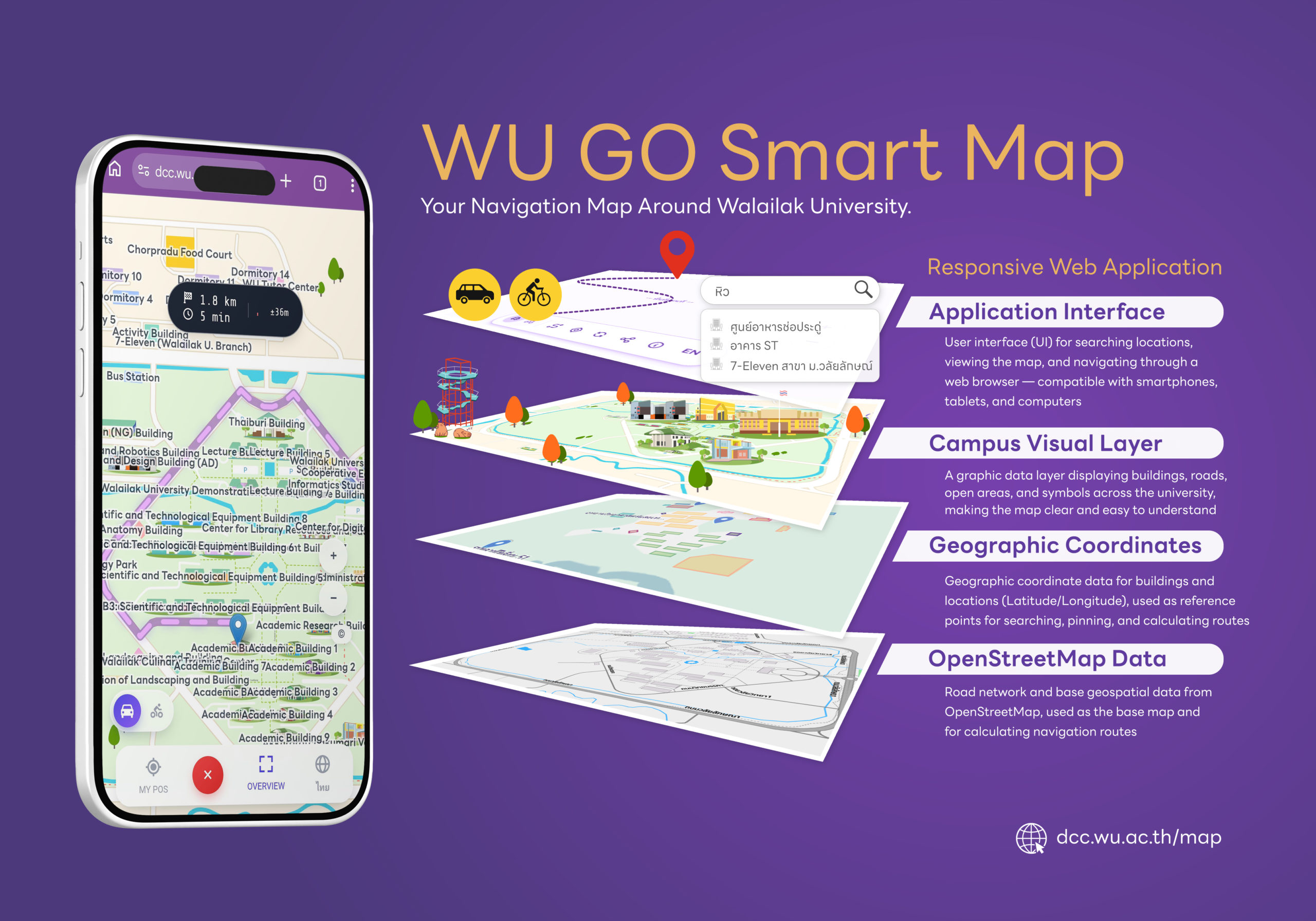
WU GO Smart Map is built as a responsive web application, layering four components to power the experience:
Application Interface – the user-facing search and navigation experience, accessible through any web browser on phone, tablet, or computer
Campus Visual Layer – map graphics depicting buildings, roads, and campus landmarks for clear, intuitive reading
Geographic Coordinates – precise latitude and longitude data for each building and facility, used for search and route calculation
OpenStreetMap Data – underlying road-network and geospatial data used as the base map and for calculating routes
Users can currently choose between car and bicycle navigation modes. According to the project’s development roadmap, the developer plans to continue developing the platform and to let users help by reporting additional locations to be added to the map.
The project was recently presented internally as part of a “Show & Share” knowledge session, organized by the Center for Digital Innovation, highlighting how university staff applied digital tools – including AI-assisted research to evaluate mapping platforms – to solve a practical, everyday campus challenge.